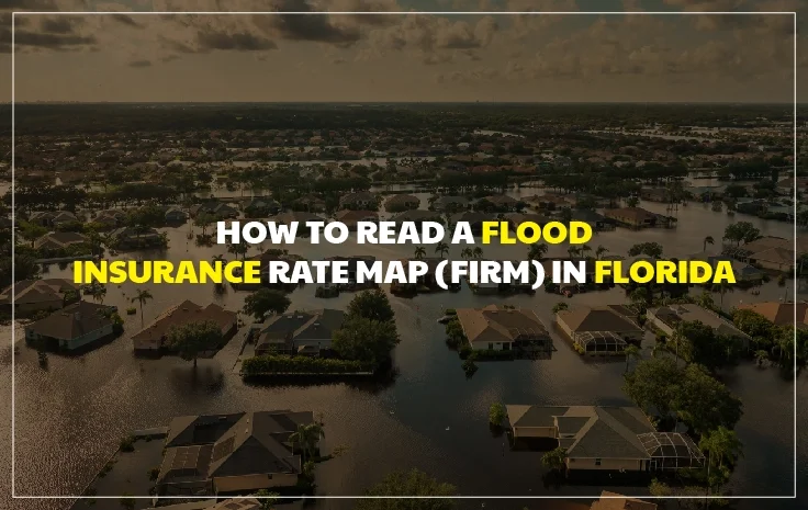
How to Read a Flood Insurance Rate Map (FIRM) in Florida: A Homeowner’s Complete Guide
If you own property in Florida, a single government document may be doing more to shape your insurance premiums, your mortgage requirements, and your long-term financial exposure than almost anything else. That document is called the Flood Insurance Rate Map, or FIRM, and most Florida homeowners have never looked at one.
FEMA produces and maintains FIRMs for communities across the United States, and these maps define the official flood risk designations for individual properties. Your property’s flood zone, as shown on the applicable FIRM, determines whether your lender requires you to carry flood insurance, what type of flood policy you qualify for, and in large part what you pay for that coverage.
In Florida, where more than 40 percent of all National Flood Insurance Program policies nationwide are concentrated, FIRMs are especially consequential. The state’s geography creates a diverse range of flood zone designations across different regions and neighborhoods, and the stakes of getting your flood zone right are real. Homeowners in incorrectly mapped zones have paid years of unnecessary premiums, while others have been caught without required coverage because they misunderstood their zone designation.
This guide will walk you through exactly how to read and understand a Flood Insurance Rate Map Florida, what the different FEMA Flood Zones Florida designations mean, and how to apply this knowledge to make informed decisions about your Florida Flood Coverage. Whether you are buying a home, reviewing your current flood insurance, or just trying to understand your property’s risk profile, what follows will give you a practical, working understanding of these maps.
What Is a Flood Insurance Rate Map (FIRM)?
A Flood Insurance Rate Map is an official FEMA document that shows the flood zones, flood plain boundaries, and base flood elevations (BFEs) for a given geographic area. FIRMs are used by:
- Mortgage lenders to determine whether flood insurance is required for a federally backed loan
- Insurance underwriters to determine flood insurance eligibility and pricing
- Local floodplain managers to enforce floodplain development regulations
- Homeowners and buyers to understand their property’s flood risk
FIRMs are produced at the community level, with each participating NFIP community having its own map or set of map panels. In Florida, this means county-level and municipality-level FIRMs exist for virtually every community in the state.
FEMA updates FIRMs periodically to reflect changes in hydrology, new development, updated elevation data, or significant flood events. These updates, called Map Revisions or Map Amendments, can change your property’s flood zone designation and have direct implications for your insurance requirements and premiums.
How to Access the FIRM for Your Florida Property
The primary tool for looking up your property’s flood zone designation is FEMA’s Flood Map Service Center, accessible at msc.fema.gov.
Here is how to use it:
Step 1. Go to msc.fema.gov in your web browser.
Step 2. Enter your property’s street address in the search field.
Step 3. The system will return a map view showing your property’s location overlaid with the applicable FIRM panel.
Step 4. Click on the map to access the FIRM panel document, which will show the flood zone designation for your area.
In addition to the Flood Map Service Center, FEMA offers the National Flood Hazard Layer (NFHL) viewer at msc.fema.gov/portal/advanceSearch, which provides a more interactive GIS-based view of flood zone data. Many Florida counties also maintain their own GIS portals that overlay flood zone data on aerial photography, which can make property-level identification easier.
Keep in mind that flood zone maps show general risk areas rather than the precise elevation and risk of every individual parcel. An elevation certificate from a licensed surveyor provides the property-specific data needed to precisely determine flood risk and accurately rate your insurance policy.
Understanding FEMA Flood Zone Designations in Florida
This is the heart of reading a FIRM. Each zone designation has a specific meaning that directly affects your insurance obligations and risk profile. Here is a breakdown of the most commonly encountered FEMA Flood Zones Florida:
Zone A (and Subzones: AE, AH, AO, A1-30, AR, A99)
Zone A is the most commonly encountered high-risk flood zone designation in Florida. Properties in Zone A have a 1 percent annual chance of flooding, which means a 26 percent chance of flooding over a 30-year period. This threshold is why Zone A is called the Special Flood Hazard Area (SFHA), and why flood insurance is typically required for federally backed mortgages on properties in this zone.
Subzone details:
Zone AE is the most common subzone in Florida. AE zones have detailed hydraulic analysis, which means a Base Flood Elevation (BFE) has been established. The BFE represents the elevation water would reach during a 1-percent-annual-chance flood event. Your property’s relationship to the BFE is the primary driver of your flood insurance premium.
Zone AH designates areas with a 1-percent-annual-chance of shallow flooding (typically ponding) with depths of one to three feet. BFEs are shown on the FIRM.
Zone AO is used for areas with a 1-percent-annual-chance of sheet flow flooding (flood flows over sloping terrain). These zones show flood depths rather than BFEs.
Zone A1-30 are older numbered zone designations now largely replaced by Zone AE in modernized FIRMs.
Zone V (and Subzones: VE, V1-30)
Zone V designations represent coastal high-hazard areas subject to wave action in addition to flooding. These zones are exclusively found along Florida’s coastline, including Atlantic and Gulf coast communities.
Zone VE is the primary coastal high-hazard zone in modern Florida FIRMs. Properties in Zone VE face the highest flood risk and the highest insurance premiums. They are subject to wave heights of three feet or more during a base flood event. Building code requirements in Zone VE are stricter than in Zone AE, including requirements for elevated construction above BFE and specific foundation requirements.
Zone V and VE properties in Florida, particularly along the Gulf Coast, Tampa Bay, and South Florida’s coastline, often carry the highest flood insurance premiums in the state.
Zone X (Moderate Risk and Minimal Risk)
Zone X is the catch-all designation for areas with lower flood risk. It appears in two forms:
Zone X (Shaded) on older maps, or sometimes labeled Zone X500, designates moderate risk areas: areas with a 0.2-percent-annual-chance flood hazard (sometimes called the 500-year floodplain) or areas within the 1-percent-annual-chance floodplain where average depths are less than one foot. Flood insurance is not federally required in these areas but is available and often advisable.
Zone X (Unshaded) designates minimal risk areas outside the 500-year floodplain. Flood insurance is not required but remains available and sensible, as flooding can and does occur outside mapped hazard areas.
Zone D
Zone D designates areas where flood hazards are undetermined. These zones are relatively uncommon in Florida, as most of the state has been analyzed by FEMA. In Zone D, flood insurance is available but not required for federal mortgages.
Zone B and Zone C
These older designations are equivalent to moderate-risk and low-risk areas, respectively, and have largely been replaced by Zone X in newer FIRMs. If your map shows Zone B or C, your property carries lower flood risk.
How to Read the Map Panel: Key Elements
When you open a FIRM panel for your Florida property, several key elements will help you orient the data:
Map Panel Number. Each FIRM consists of numbered panels covering specific geographic areas. The panel number helps identify which portion of the community map you are viewing.
Map Effective Date. This tells you when the current map panel was last officially updated. FEMA updates FIRMs periodically, and an older effective date may mean your area has not been remapped with newer data.
Flood Zone Labels. The map uses letter and alphanumeric codes (A, AE, VE, X, etc.) directly on the map to label each flood zone area. Zone boundaries are shown as lines on the map.
Base Flood Elevations (BFEs). In Zone AE areas, BFEs are typically shown as elevation numbers along floodplain boundaries or as contour lines. These represent the water elevation (in feet above mean sea level) during a 1-percent-annual-chance flood.
Floodway. On many Zone AE maps, a Floodway area is identified. The floodway is the channel of a river or stream plus any adjacent floodplain areas that must be kept free of encroachment to pass the base flood without increasing flood heights significantly. Properties within a floodway face the strictest development restrictions.
Legend. The map’s legend explains all symbols, colors, and labels used. Always check the legend when interpreting any map element you are unsure about.
Elevation Certificates: The Property-Specific Complement to FIRMs
A FIRM tells you your flood zone. What it cannot tell you is the precise elevation of your specific structure relative to the Base Flood Elevation. That is where the Elevation Certificate (EC) comes in.
An Elevation Certificate is prepared by a licensed land surveyor, engineer, or architect and documents:
- The elevation of the lowest floor of your building
- The elevation of any attached garage
- The elevation of any machinery or equipment servicing the building
- The relationship between all of those elevations and the BFE shown on the FIRM
The difference between your building’s lowest floor elevation and the BFE is one of the most significant factors in your flood insurance premium calculation. Properties elevated above the BFE pay lower premiums. Properties with floors below the BFE pay higher premiums.
For many Florida homeowners, obtaining an elevation certificate from a licensed surveyor (typically $300 to $700) can reveal that their home is elevated higher above the BFE than the NFIP assumed, resulting in substantially lower premiums. The savings from a corrected premium rate can easily exceed the cost of the certificate within a year or two.
Map Amendments and Revisions: Can Your Flood Zone Change?
Yes. Your flood zone designation can change in two important ways:
Letter of Map Amendment (LOMA). If you believe your property has been incorrectly included in a high-risk flood zone due to a mapping error (for example, your land is actually higher than the FIRM shows), you can apply to FEMA for a LOMA. If FEMA agrees, they will issue an amendment removing your property from the SFHA, which typically eliminates the mandatory purchase requirement.
Letter of Map Revision (LOMR). A LOMR reflects physical changes to the floodplain itself, such as a flood control project or new development that altered drainage patterns. LOMRs can move properties in or out of high-risk zones.
Community-wide map updates. FEMA periodically conducts comprehensive map updates for Florida communities. These updates can significantly reclassify large areas, moving properties from low-risk to high-risk zones or vice versa. When a property is newly mapped into a high-risk zone, affected homeowners typically have access to Preferred Risk Policy pricing for an initial period as they transition to the higher-risk classification.
FAQs:
Q: Where can I look up my Florida property’s flood zone for free?
A: FEMA’s Flood Map Service Center at msc.fema.gov allows you to look up any address in the United States, including all Florida properties, and view the applicable flood zone designation at no cost.
Q: What does Zone AE mean for my Florida home?
A: Zone AE is a high-risk Special Flood Hazard Area with a 1-percent annual chance of flooding. A Base Flood Elevation has been established for the area. If you have a federally backed mortgage on a property in Zone AE, flood insurance is typically required.
Q: My Florida property shows Zone X on the FIRM. Do I still need flood insurance?
A: Flood insurance is not federally required for properties in Zone X. However, FEMA data shows that roughly 25 percent of flood claims come from properties outside high-risk zones. Flood insurance is available and often advisable even in Zone X, and Preferred Risk Policies offer affordable coverage options.
Q: Can I challenge my flood zone designation in Florida?
A: Yes. If you believe your property has been mapped incorrectly, you can apply to FEMA for a Letter of Map Amendment (LOMA) if your property’s ground elevation is at or above the BFE. An elevation certificate from a licensed surveyor is typically required.
Q: How often are Florida flood maps updated by FEMA?
A: FEMA updates FIRMs on a rolling basis as new data becomes available. The timing varies by community. Many Florida communities have received map updates in recent years as part of FEMA’s flood map modernization initiatives.
Q: What is a Base Flood Elevation (BFE) and why does it matter?
A: The BFE is the elevation that floodwater is expected to reach during a 1-percent-annual-chance flood event. Your building’s elevation relative to the BFE directly affects your flood insurance premium. Buildings elevated above the BFE pay lower premiums; buildings below the BFE pay higher premiums.
Work with a Florida Insurance Expert on Your Flood Coverage
Understanding your FIRM is the first step. Translating that information into the right flood insurance policy for your Florida property is the next one.
At Best Choice Insurance Agency, our team helps Florida homeowners interpret their flood zone designations, review elevation certificates, and compare NFIP and private flood insurance options to find coverage that genuinely matches their risk and their budget. Contact us today for a Florida Flood Coverage review.